Bird farm names
Other - other
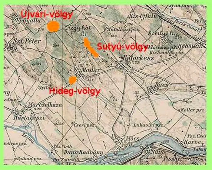
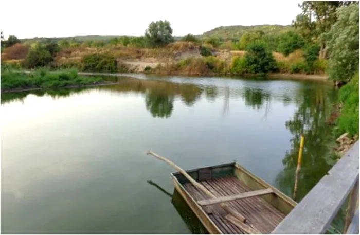
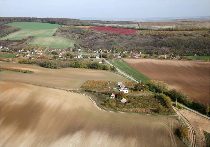
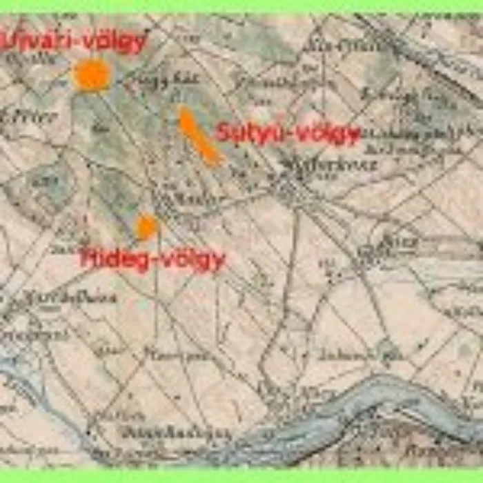
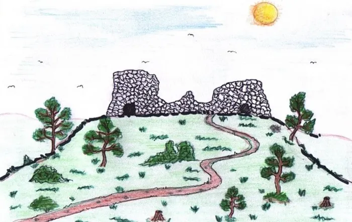
Madar is located in the Mátyusföld region. The village covers an area of 74 hectares, its borders are 1986 hectares, and its altitude is between 115 and 250 meters above sea level. The hills have their “mountain names”: Kőhegy (180 m), Villámhegy (197 m), Leshegy (197 m), Várhegy (210 m), Agghegy (216 m), Kecskehegy (202 m), Farkasverem (209 m), Pokolhegy (152 m). The settlement has three large valleys: the Hideg-völgy in the west, the Újvári-völgy in the middle, and the Sutyu-völgy, i.e. the vineyard hill itself, in the east. ; The Bekötő road has existed since the time when the houses were built in Kertalja. It serves as a kind of shortcut so that the residents did not have to go far if they wanted to get here. The name Kertalja indicates its location in relation to Fő utca, as the new row of houses was formed behind the gardens belonging to the houses on Fő utca. The barber moved to Bekötő út around 1970, and the hairdressing salon is still here today. It connects Kertalja with Fő utca. Fő utca is the longest and oldest street in the village. There are no official street names in the village, only the names that are in common use. ; The Czibor family owned the area next to the Brick Kiln, the Czibor Valley. It was a grassy area where geese, cattle, and pigs were grazed. Today, there are also residential houses here. In the old days, there were cellars dug into the ground here, in which potatoes, carrots, and vegetables were stored. These cellars are still there today, but they are no longer used. The name Téglaégető comes from the fact that in the 1950s, gypsies still used to lay adobe here (vályogvető gypsies). It has now been built up with residential buildings. ; From the end of the Middle Ages, an important war route ran past Madar. During the Turkish and Kuruc times, Vár-hegy served as an observation post. Today, it only looks like a weedy hill, but it is an inhabited area. It was once a favorite playground for the boys of Madar. According to oral tradition, King Matthias's birders (birds) were here. Kishegy belongs to the Vár-hegy range. On the right side of Fehérpor lies Vár-hegy, on the left side is Kishegy, which is also an inhabited area today. White sand-like dust covered the road, in which children liked to “walk barefoot”. Hence the name. ; The forest behind the stream is called Závoda. Between the stream and the Závoda there were small plot-like gardens in which potatoes and carrots were grown. There were gardens here that were not fenced. According to the rumor, the name Závoda is of Slovak origin: za vodou – behind the water. The Goose Meadow was a grassy meadow between the Stream and the Závoda, where the goose herders kept the geese. Part of it is already an inhabited area. ; The Stream originates from the Upper Lake, which is now only referred to as Kanális. It was also used as a hemp soaking place in the past. There is a forest to the right next to it, through which we can reach Perbete. The Kanális (Stream) crossed the village from the upper end of the village to the lower end. The Stream was cleaned up and has since been called Kanális. is called. ; Bán is a hill, vineyard and arable land located near the Sutyu Valley. ; Kecske-hegy - 202 m, located after the Elő-hegy. According to the village legend, on this hill a witch turned the charming daughter of the village judge into a goat. She tied her to a stake and beat her three times a day with a stick. At such times, when the wind blew, she would bring bitter weeping to the village from the mountain. ; The village population is predominantly Calvinist. The cemetery serves as the resting place of several famous pastors. Grape growing is done in the Cemetery-dűlő. From here, heading east, we reach the Sutyu Valley through the árendásoks. árendásoks were the name of the rented arable land. ; The Mélyút leads from the left hand side towards the Sutyú Valley to the Menyecske Valley. ; The Jewish cemetery was located on the land of a Jewish family next to the Mélyút on a vineyard hill. Since few Jewish families lived here, they were buried here. Around 1970, the last Jewish family had the tombstones moved to the Jewish cemetery in Komárom. ; Sutyú Valley Sutyu-, Sutyús-valley is located in the eastern part of the village – this is the vineyard hill. In the village, grape pressing was called sutyulas – that is where Sutyú-valley got its name. ; Menyecske-valley is part of Sutyu-valley. According to legend, boys chased girls, menyecske, in this place. That is where it got its name. ; Templom-köz belongs to the small streets of the village: this road leads from Fő utca to the cemetery, and from there continues to Sutyú-valley. ; Kangyi-köz: at one time only Roma lived here. This street also leads towards the cemetery and to Sutyú-valley. ; Petrás-köz, Madócsai-köz: It was referred to by both names, with this name families lived here. This alley also leads to the cemetery. In the 50s and 60s, dead people were even taken to the cemetery through this alley. It flows into Fő utca, opposite Bekötő út. ; The Upper and Lower Lakes are connected by the Canal running through the village. They washed in both lakes and the stream, especially linen. The lakes dried up during periods of great drought and filled up again during rainy weather. This is no longer the case. Today, the Lower Lake has completely dried up. ; The péró was at the lower end of the village. It was once exclusively inhabited by gypsies, but has now been eliminated. ; The Pokol-hegy - 152 m. According to legend, its name was given when the first monk preached here. On this hilltop, a single tree reached up to the sky among the dry thorn bushes. Dark clouds came, from which a huge storm arose, and the one of the lightnings set the dry bushes on fire. The monk then shouted that whoever does not become a Christian will burn in hell like a bush in a fire. Hence the name Pokol-hegy. ; Next to Tófenék was Kis-Madar: there used to be orchards and gardens here, and the market square was next to it. It was on the site of the current kindergarten and to the south of it. Patkó Street got its name from its shape. ; Other telling names belong to the outskirts of the village. One such is Hideg-völgy, where according to ten years of weather data the temperature is 4-5 degrees lower than in other places in the village. Les-hegy got its name from the attackers who ambushed and beat the Calvinists who were trying to reach the articular place of worship. ; Agghegy – Akasztóhegy, on which the sinner was hanged on a gallows and left there for a day as a deterrent. ; Farkasverem is said to have been trapped The wolf king once rescued fallen wolves from there.