The 1938 border crossing
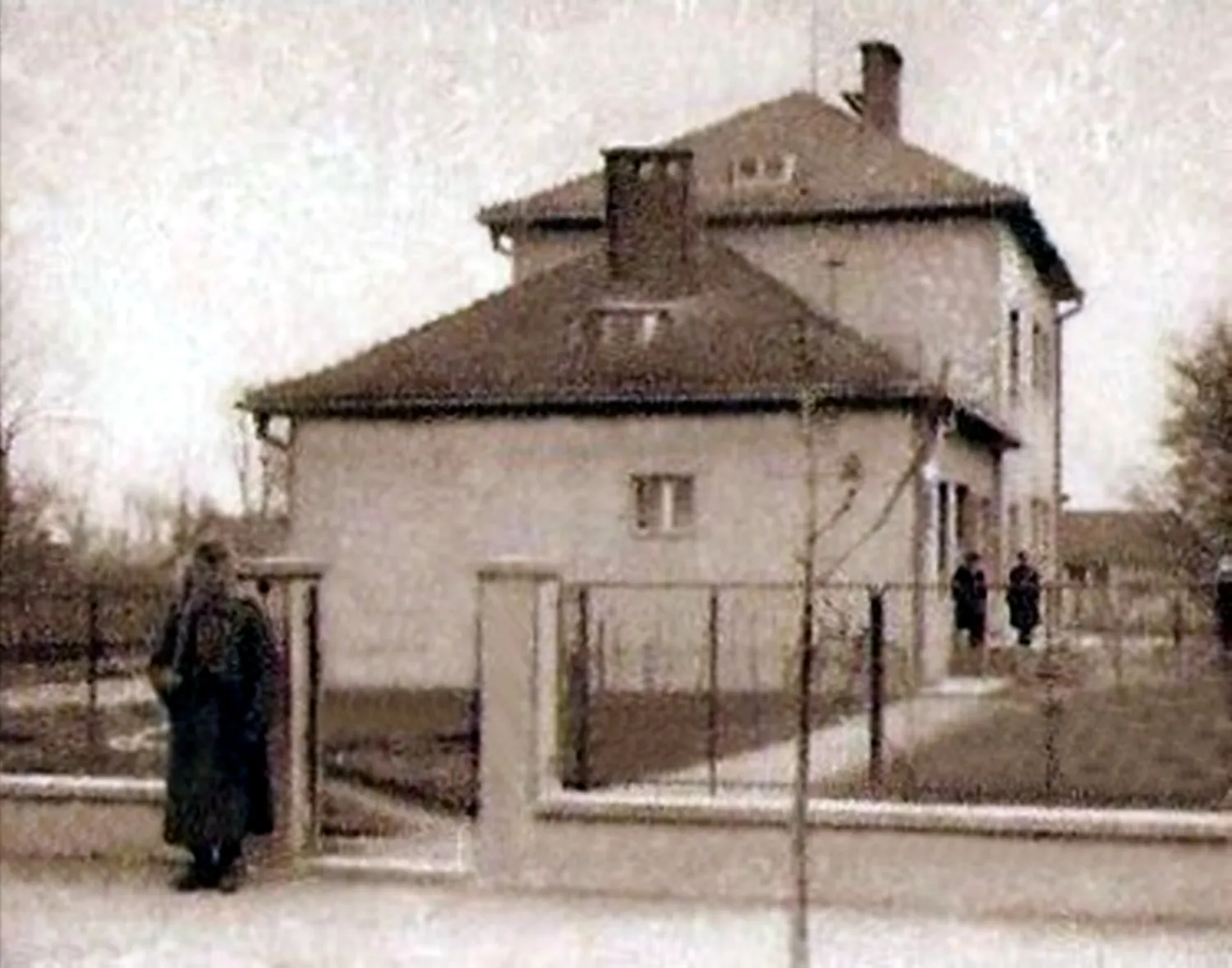
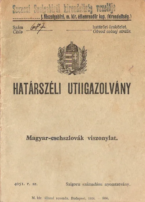
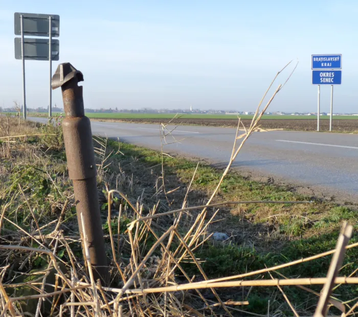
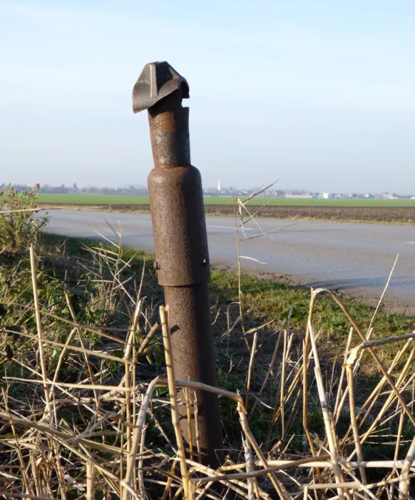
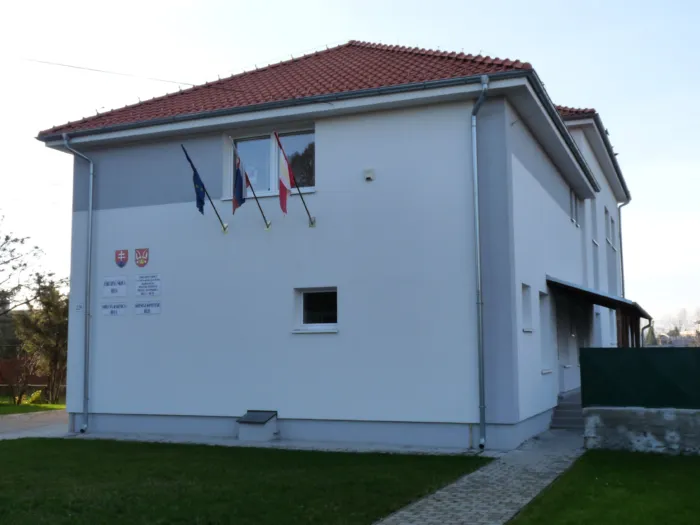
Next to the road connecting Rété with Németgurab, the stump of the crossing barrier that handled minor border traffic from December 1938 to April 1945 can still be seen. The building that housed the garrison also stands, which today functions as a school. ; On October 6, 1938, the Slovak parties in Žilina announced the autonomy of Slovakia, thus establishing the Slovak government, whose president was Jozef Tiso. On October 9, 1938, the Czechoslovak-Hungarian negotiations began in Komárom. Here, Czechoslovakia was represented by the territorially interested, autonomous Tiso government. Since they could not agree on some important details, for example, the Slovak side was unwilling to take into account the real ethnic situation, German-Italian arbitration was called for. On November 2, 1938, in Vienna, the foreign ministers of the two countries, Ribbentrop and Ciano, decided to take the ethnic principle into account when drawing the new borders. As a result, 53 settlements in the Matthias Land were returned to Hungary. Hungarian soldiers arrived on November 10. ; Hungary regained 11,927 km², mostly the southern part of Czechoslovakia (more precisely, the then autonomous Slovakia), including the southern part of Transcarpathia. According to the 1941 Hungarian census, 84 percent of the 1 million 62 thousand residents transferred were Hungarian and about 10 percent Slovak. ; Thanks to the first Vienna decision and the recapture of Transcarpathia, the new Hungarian border (until 1945) ran along the borders of the following settlements, moving from west to east: ; Starting from the Danube: Somorja, Úszor, Csutörök, Fel, Dunasáp, Szenc, Réte, Magyardiószeg, Nagymácséd, Galánta, Nemeskajal, Vágsellye, Tornóc, Tardoskedd, Komját, Nyitranagykér, Nagycetény, Verebély, Mohi, Újbars, Léva, Vámosladány, Hontfüzesgyarmat, Deménd, Egeg, Palást, Ipolynyék, Kőkeszi, Lukanénye, Zsély, Bussa, Felsőzellő, Vilke, Gács, Losonc, Losoncapátfalva, Pinc, Osgyán, Rimaszombat, Alsópokorágy, Balogpádár, Felsőbalog, Felsővály, Felsőfalu, Deresk, Jolsva, Szalóc, Berzéte, Rozsnyó, Barka, Ájfalucska, Jászó, Aranyida, Hernádtihany, Kassaújfalu, Garbócbogdány, Füzér, Alsómihályi, Bodzásújlak, Garany, Abara, Nagyráska, Deregnyő, Vaján, Nagykapos, Lakárd, Bező, Sárosmező, Szobránc, Szobráncfürdő, Felsőhalas, Remetevasgyár, Kiskolon, Takcsány, Cirókafalu, Zellő, and here the new border reached the spine of the Carpathians, i.e. the historical Hungarian border, along which it then extended southeastward, all the way to the southeastern border of Székelyföld. ; The unification of the re-annexed territories with the mother country was declared by the XXXIV. Act of 1938. ; The demarcation line established between the two countries was temporarily almost impassable until December. Based on the proposal of the Slovak side, crossing the demarcation line was only possible along the route of the established customs offices. ; During the bilateral negotiations in Podebřád, an agreement was reached between Slovakia and Hungary on the mutual opening of local border traffic with effect from 5 December 1938. Local border traffic opened at 12 noon based on the negotiations. ; In the Mátyusföld region, the following customs routes could be used during border traffic: Németbél–Tótgurab, Szenc–Svajnsbach, Szenc–Sárfő, Boldogfa–Csataj, Réte–Németgurab, Pusztafödémes station–Pusztafödémes, Magyardiószeg–Pusztafödémes, Nagymácséd–Ábrahám, Nagymácséd–Szered, Barakony–Vágszerdahely, Vághosszúfalu–Kövecsespuszta. ; The border security of the re-annexed Mátyusföld area was provided by the 8th Hungarian Border Patrol Battalion of the Hungarian Royal Army. The battalion units were stationed in Galánta, but the battalion had 8 guards in the border villages from Felsőjattó to Szenci. ; The small border crossings were mainly used by farmers and seasonal agricultural workers in the border zone. To cross the border, they needed a temporary border crossing card issued by the notary's office or the gendarmerie station. From January 4, 1939, the small border traffic was reduced from 15 kilometers to 10 kilometers from the demarcation line. After the border was stabilized, 161 small border crossings were available to the population on the Slovak-Hungarian border section. Citizens who did not live in the border zone had to use the key international border crossings, with passport requirements (31 road border crossings, 17 international railway lines and 3 waterways).